Post-meeting field trip 3
The Tatras - rocks, landforms, weathering and soils
The Tatras
The Tatra Mountains are the highest part of the Carpathians (Gierlach, 2655 m ASL). These are the most significant, presently non-glaciated mountains in Central Europe within the entire Carpathian Chain. They are located approximately halfway between the Baltic Sea and the Adriatic Sea and between the Atlantic Ocean and the Ural Mts. Thus, they occupy a transitional position between maritime Western Europe and the continental East European lowland.
Rocks, mountains and landscape
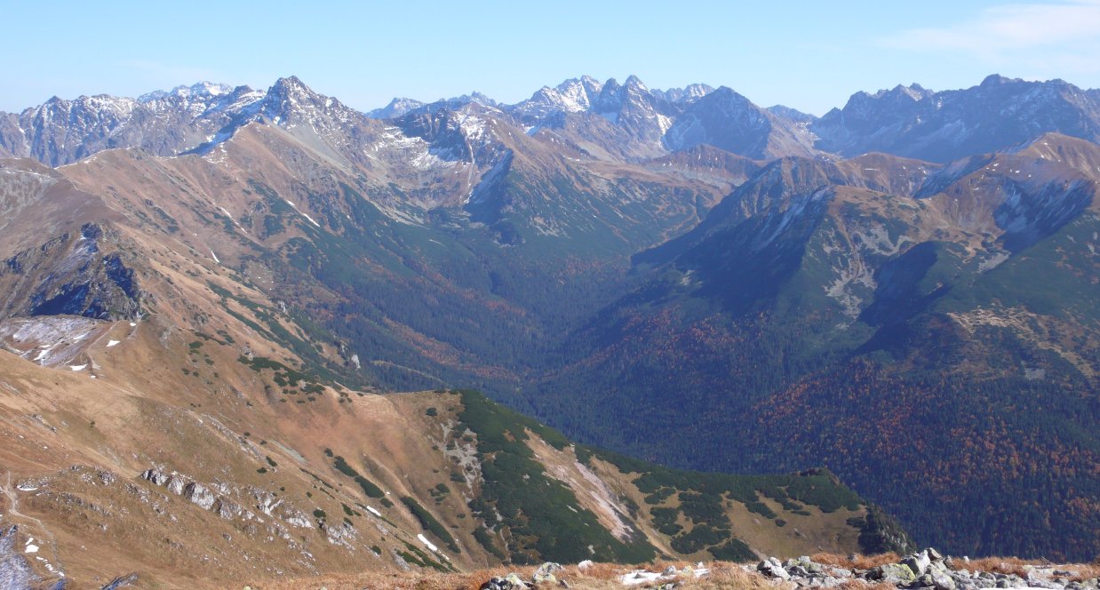
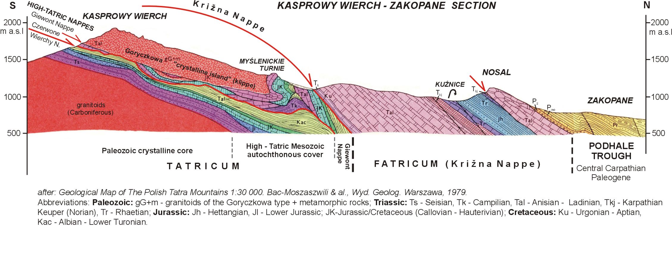
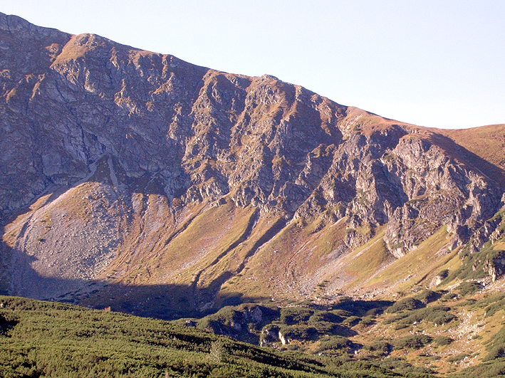
Well-developed alpine landscape is controlled by two main factors: geological structure of the mountains and their reshaping by the glaciers during the glacial epoch (Pleistocene). Generally, two major units form the Tatras: crystalline core (intrusive granitoids and metamorphic gneiss) and sedimentary cover (mostly carbonates that form several nappes; see geological section below). The W-E "geological" axis of the mountains is undulated. Elevated parts generally consist of granites (the High or Eastern Tatras), while sediments are preserved in depressions (mostly in the Western and Belianskie Tatras). Therefore, the High Tatras are more resistant to dissection and planation and, thus, are higher today, than other parts of the mountains. They were higher at the beginning of Pleistocene too. Larger parts of their flat valley floors were located above the snow line and, thus the glaciers in the High Tatras were longer, thicker and more active than the glaciers in the Western Tatras. As a result of a coincidence of two agents: resistant rocks and intense glacial erosion, the High Tatras reveal today much more high-alpine appearance than the Western and Belianskie Tatras.
Glaciations
There were 3 or 4 main glacial events in the Tatras, separated by warm, ice-free interglacial periods. However,only the remnants of the last glaciation (Alpine Würm correlated with continental Vistulian, which ended approx. 10 thousand years ago) are seen today in the mountains: cirques, U-shaped and hanging valleys, lateral and terminal moraines, valley shoulders, and infilled proglacial lakes. Traces of older glaciations were almost entirely erased by the youngest glaciers. However, sediments related to them are preserved in the Tatra surroundings (in Podhale, Spisz, Orawa and Liptow).
Periglacial processes and landforms
Areas free from ice were subjected to intense periglacial processes. Some of these processes, are still active, e.g.: multi-annual and seasonal ground freezing, solifluction, frost sorting, cryoturbation, frost shattering, frost jacking. As a result, solifluction lobes, small thufurs, patterned ground and block fields can be seen high in the mountains (see Stop 4. Liliowe Pass).
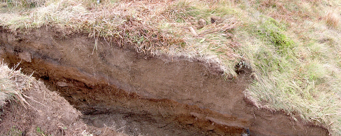
Soils
The Tatra Mountains reveal well-developed geo-ecological zonation - from the lower mountain zone to the alpine zone, including the vertical zonation of soils. The properties of the soils (morphology, chemistry and taxonomical position) reflect the geo-ecological conditions. The main soil-forming processes on crystalline rocks, organic matter accumulation and podzolisation, are strongly represented. Rendzic Leptosols (Umbric, Humic) dominate on carbonate parent rocks. Muck-like organic matter of the alpine moder (under alpine meadows) and tangelmor type (under dwarf pine communities) occurs and is characterized by a high concentration of organic carbon, and low bulk density. The organic matter is poorly bound with the mineral parts, and the humification index expressed as content is varied. The soils are very acidic and contain considerable amount of pebble and stony rock particles.
Clay minerals
The clay mineralogy of Tatra podzols developed on granitic regolith has been studied in detail in seven podzol profiles, which macroscopically represent different stages of soil development (from very initial at Beskid Mountain to advanced in the Sucha Woda Valley).
The main processes responsible for clay minerals presence are:
- inheritance of mica (mainly dioctahedral) and chlorite from the parent rocks;
- crystallisation of kaolinite; vermiculitisation of inherited dioctahedral mica;
- formation of dioctahedral smectite at the expense of vermiculite.
The proposed sequence of dioctahedral mica transformation is as follows: M → R0 M-V (12 or 14 Å) → R0 M-V (12 Å V) → R1 M-V (12 Å V) → 12 Å V → V-S → S. Formation of hydroxy-interlayers were observed in some of the B horizons with pH≥4.4. The process of dissolution of primary silicates was also documented. For more details on the clay aspects of podzolisation in the Tatra Mountains see Skiba (2007).
References:
Skiba M., 2007: Clay mineral formation during podzolisation in an alpine environment of the Tatra Mountains, Poland. Clays and Clay Minerals 55, 529-545.
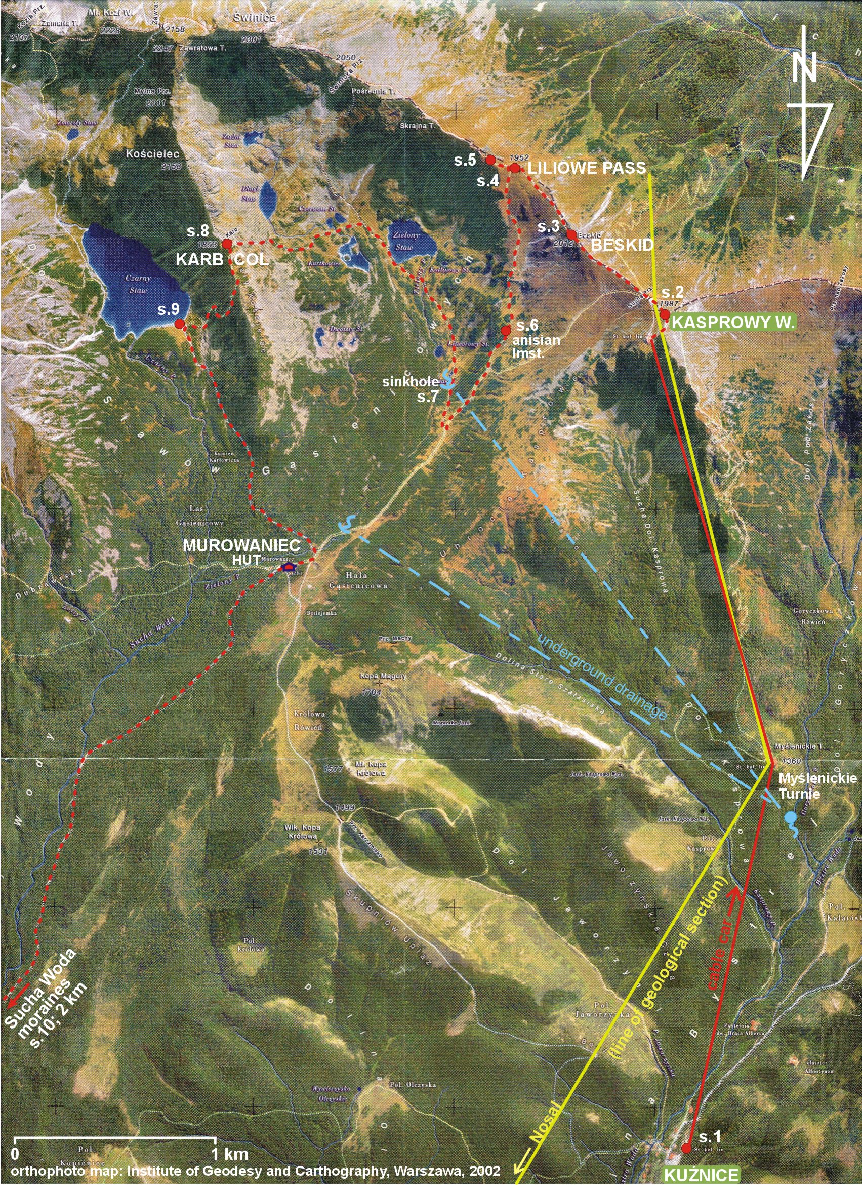
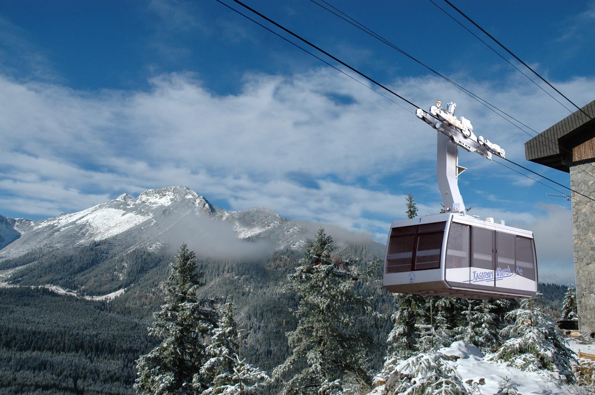
Stop 1. Kuznice
The Cabin Aerial Ropeway to the Kasprowy Wierch Peak
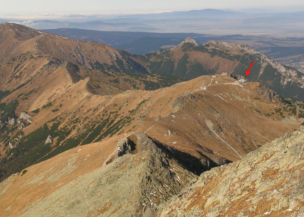
Stop 2. Kasprowy Wierch Peak
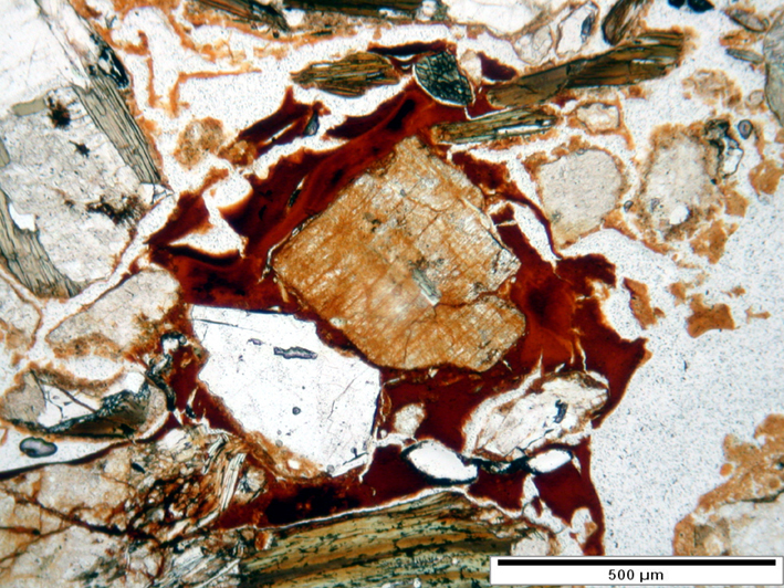
Stop 3. Beskid Peak
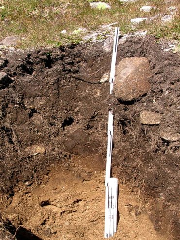
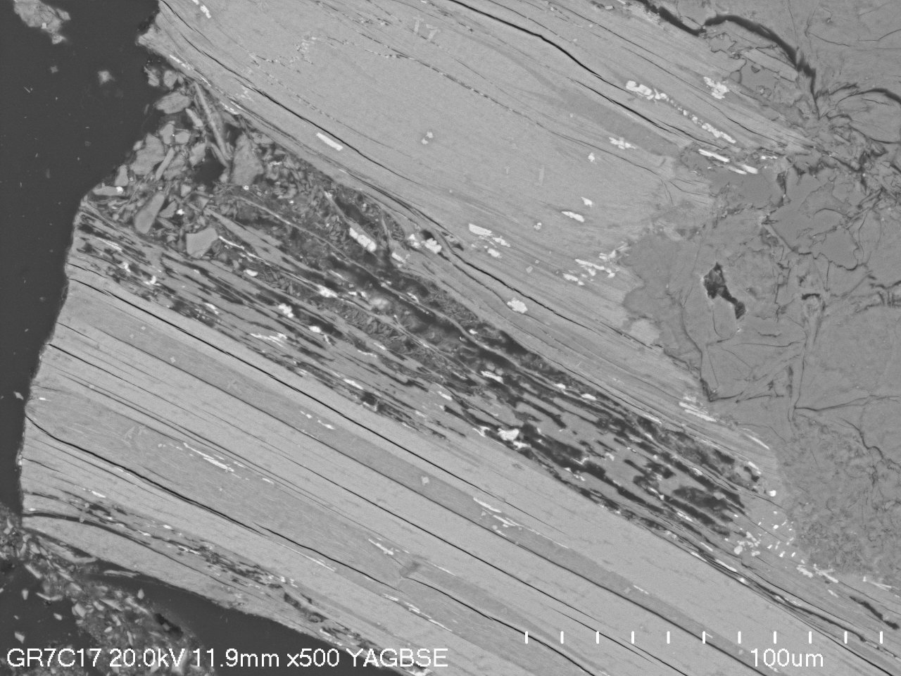
Two types of pedogenic coatings within spodic horizons (Leptic Podzol - Beskid).
Stop 4. Liliowe Pass
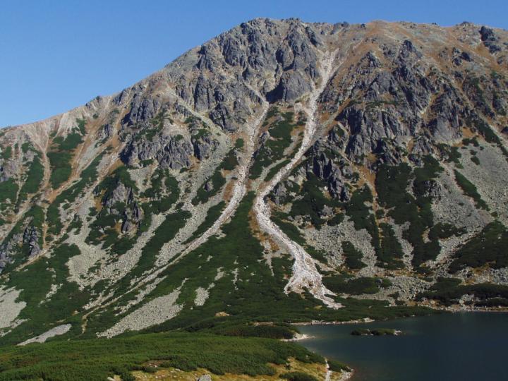
Boundary between High and Western Tatras.
Stop 5. Skrajna Turnia
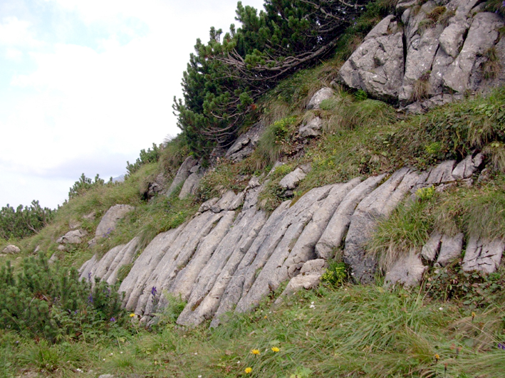
Pre-Triassic fossil weathering zone developed onto granitoids of the Tatras crystalline core.
Stop 6. Anisian limestones
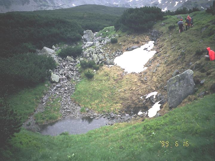
Stop 7. Sinkhole
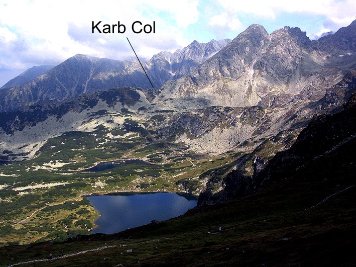
Stop 8. Karb Col
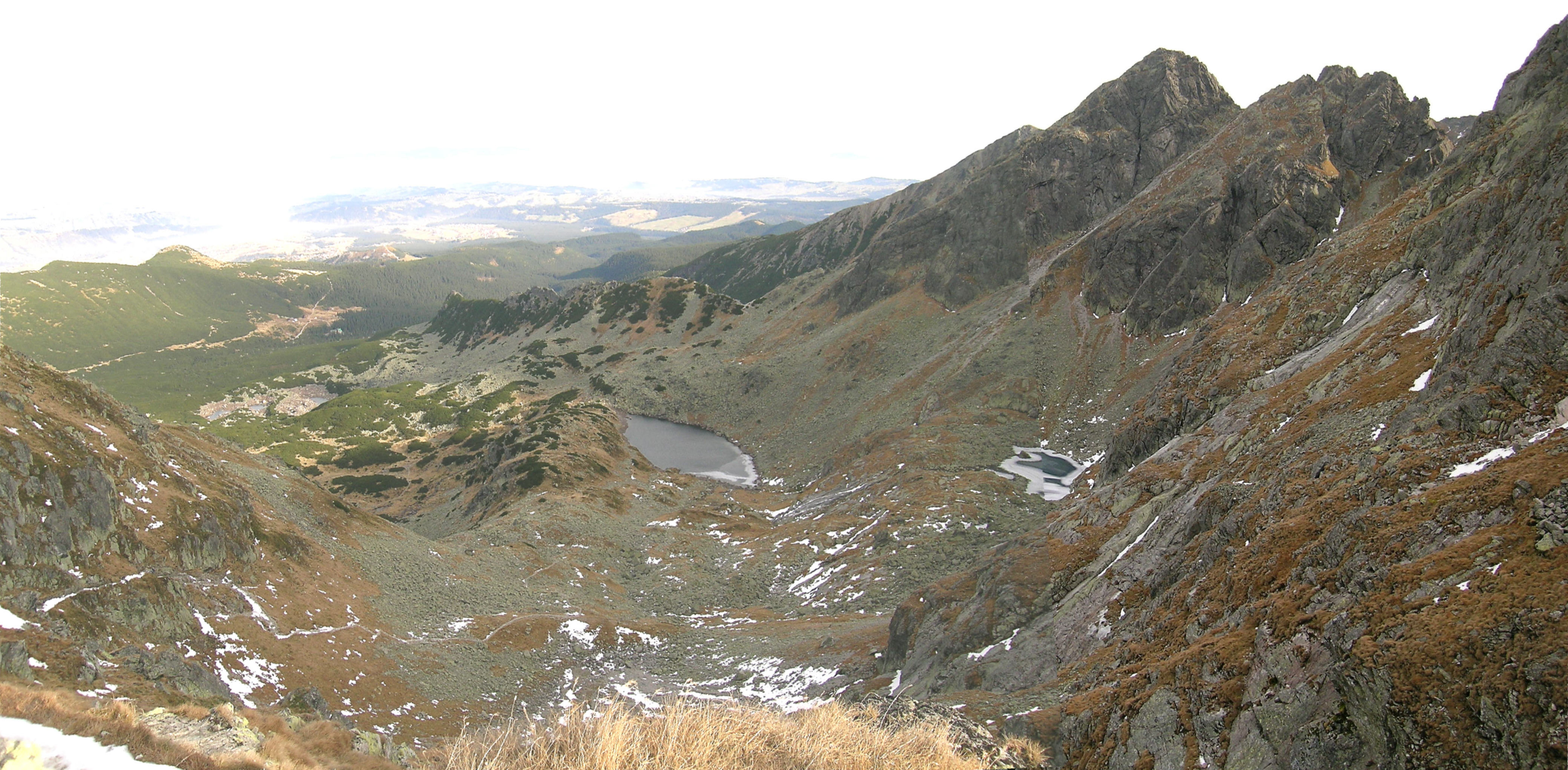
Stop 9. Czarny Staw Gasienicowy (Black Lake)
Stop 10. Sucha Woda moraines (optional stop, no photo available)
